Wer nach einer ganz besonderen Wanderregion sucht, der sollte seinen Blick nach Osttirol schweifen lassen. Diese Region fungiert als Grenzland zwischen Gebieten. Vorarlberg zum Beispiel trennt die Schweiz von Tirol und ist demnach von beiden Wanderregionen geprägt. Ähnlich verhält es sich mit Osttirol. Der Name zählt diesen Bezirk ganz klar zum Bundesland Tirol, aber eigentlich liegt Osttirol zwischen den Welten und wird auch wesentlich von Kärnten und Salzburg beeinflusst. Das zeigt sich vor allem beim Wandern. Wer schöne Seen sehen möchte, der sollte in Kärnten wandern. Wer wandern gerne mit Kultur verbindet, der kann sich im Bundesland Salzburg nach schönen Wanderwegen umsehen. Wer das wandern gerne mit traditioneller Kulinarik verbindet, der wird garantiert in Tirol fündig.

Osttirol Knödel, © Lisa Mattis
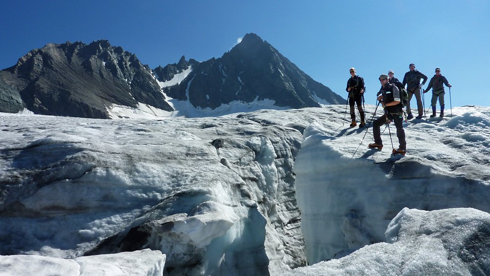
Kalser Gletscherreise, © Bergführerverein Kals am Großglockner, Nationalpark Hohe Tauern, Osttirol Werbung
Welche Ausflugsziele lohnen sich in Osttirol besonders zum Wandern?
Ganz oben auf jeder Liste sollte eindeutig der Nationalpark Hohe Tauern stehen. Obwohl dieses legendäre Naturdenkmal auch von Kärnten aus erreichbar ist, nutzen viele Wandergruppen eher Osttirol als ihren idealen Ausgangspunkt bzw. ihre Unterkunft. Diverse Ranger können sogar die idealen Guides für eine Tour Richtung Gletscher sein. Und sobald das ewige Eis erreicht wurde, wird sich ein Anblick im Gedächtnis jeder Wandergruppe jeden Alters festfrieren. Der Blick zwischen die vordere Eisplatte und dem Geröll darunter. Allein diese Erscheinung schenkt eine gute Vorstellung davon, wie ein Gletscher sich bewegt.
Die Landschaft Osttirols während der Wanderferien erleben
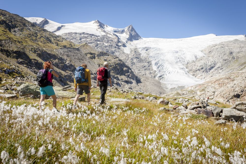
Osttirol liegt im Grenzgebiet zwischen Kärnten und Salzburg, umgeben von 266 Dreitausendern und den Lienzer Dolomiten. Im Tiroler Bezirk Lienz, wie Osttirol auch genannt wird, liegt selbstverständlich der Großglockner. Die Region ist also eindeutig von hohen Bergen geprägt, die sich für besonders ambitionierte Weitwanderungen eignen. Zwei gute Beispiele wären der Adlerweg und der Herz-Ass Villgratental. Durch die Naturschutzgebiete vermittelt die gesamte Wanderregion auch einen sehr authentischen Eindruck der alpinen Natur. Von dichten Wäldern bis tosenden Wasserfällen fehlt dort nichts, was die Bergwelt der Alpen ausmacht.
Wandern im Nationalpark Hohe Tauern Osttirol, © Martin Lugger
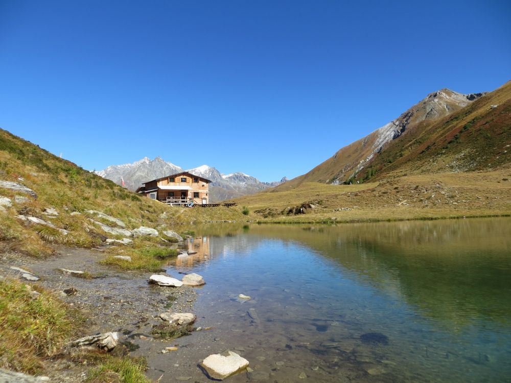
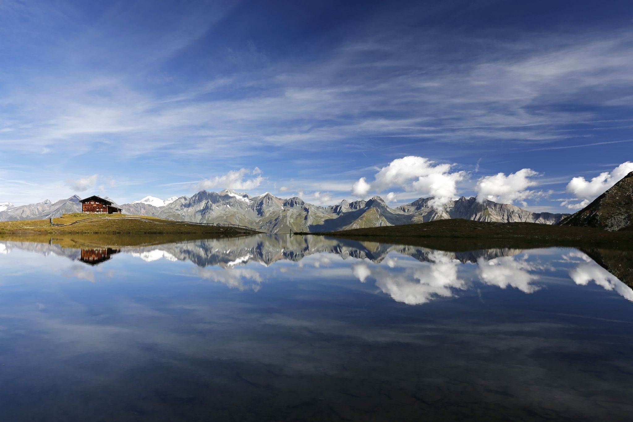
Bergersee mit Bergerseehütte in Osttirol, © Osttirol Werbung
Osttirol ist das Land der beliebtesten österreichischen Hütten
Nicht nur die Natur ist ein idealer Gastgeber im Bezirk Lienz. Die ansässigen Hütten beweisen sich ebenso immer wieder als Highlights. Die Osttiroler Einkehrstationen schaffen es immer wieder unter die Top 3 der beliebtesten Hütten. Im Jahr 2016 durften sich das Berghaus Außergschlöß und die Stabanthütte Sieger des Ratings nennen. Unsere Wanderangebote sind selbstverständlich immer rund um solch hohe Popularität und das Feedback unserer Besucher herum geschnürt.
„Berge sind stille Meister und machen schweigsame Schüler.“ (Johann Wolfgang von Goethe)
 Der einzige Wandernewsletter, den du brauchst!